Government
NJTA Lighting Improvements at Various Interchanges
- Owner: New Jersey Turnpike Authority (NJTA)
- Completed: August 2025
- Services: Land Surveying Services
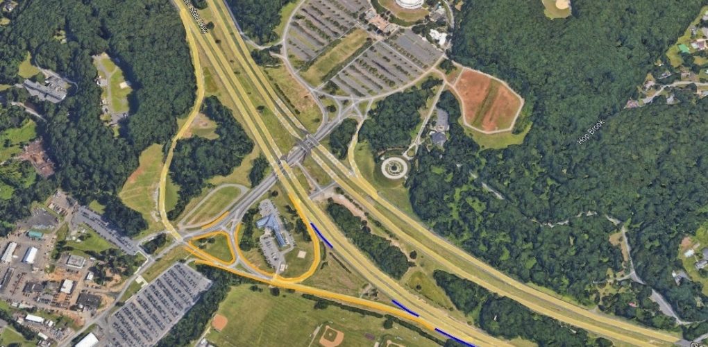
MFS Engineers & Surveyors provided photogrammetric mapping and survey services for the design of lighting improvements at various interchanges between mileposts 154-172 and 142-152. The project required precise topographic mapping and supplemental field surveys to support the design efforts.
The team utilized photogrammetric methods to develop detailed topographic mapping. Preflight targets were set and surveyed for accurate location and elevation data. New 7.5 cm GSD digital aerial imagery was acquired, controlled, and processed through aero triangulation. All visible planimetric features, both natural and man-made, were compiled photogrammetrically at a scale of 1” =30’. Terrain breaklines and spot elevations were digitized and combined with ground-level planimetric data and LiDAR data to create a SelectCAD Digital Terrain Model. This model was used to generate 2 ft contours.
Skilled technicians performed the mapping under the direct supervision of Certified Photogrammetrists, ensuring adherence to ASPRS Positional Accuracy Standards for Digital Geospatial Data. The final mapping was prepared according to NJTA specifications using MicroStation V8i/SelectCAD. The photo control and mapping outputs were delivered in the NJ State Plane Coordinate System NAD83/NAVD 88 in US feet.
To supplement the aerial mapping of lighting features, conventional surveying was conducted. The team utilized a combination of GNSS RTN and conventional survey methods. Survey control was established as needed using GNSS RTN and Leica SmartNet to support the field edit. Mapped lighting features, including light poles, electrical cabinets, and exposed electrical conduits, were identified, while non-mapped lighting features were surveyed and documented. Where applicable, lighting features were labeled with their ID numbers. Drainage inverts were not included in the scope of work.
All survey data were tied to the NAD 83 New Jersey State Plane horizontal datum and NAVD 88 vertical datum, ensuring accurate and consistent geospatial positioning throughout the project.